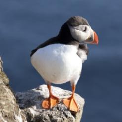
One of the things that has always set birds aside from humans is their navigational ability, migrating thousands of miles each year while we land dwellers fiddle with our maps or get sent the wrong way yet again by irritatingly unreliable satellite navigation systems.
Nevertheless, a select group of puffins are now aboard the sat nav bandwagon, as part of a project by the National Trust designed to track their daily flight paths.
GPS systems have been fitted to 12 birds in and around the Farne Islands off the Northumberland coast, in order to identify feeding ‘hotspots’, areas which may be targeted for conservation in order to protect the puffin’s future survival.
The research has shown that in addition to established breeding areas on land, the birds are heading to specific areas 20 miles out to sea, whereas they were previously thought to be heading anything up to 60 miles out.
Sixteen puffins were also temporarily fitted with time-depth recorders, to show how often they dive into the sea, how deep they go and for how long.
Furthermore, last year, small geo-locators were fitted to the leg rings of eight birds to find out where they disappear to in winter – two have so far returned and the data is waiting to be analysed.
2008 saw a dramatic 30 per cent decline in puffin numbers, though they have rallied with 5 per cent increases in the two years since.


